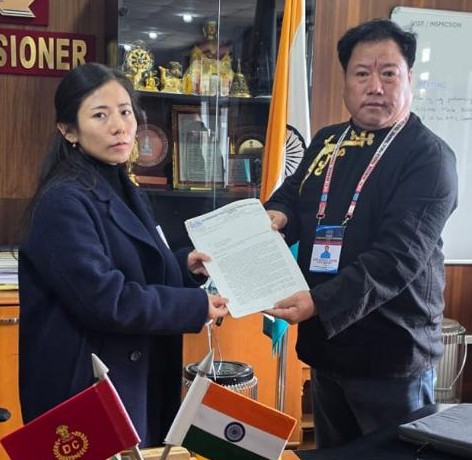
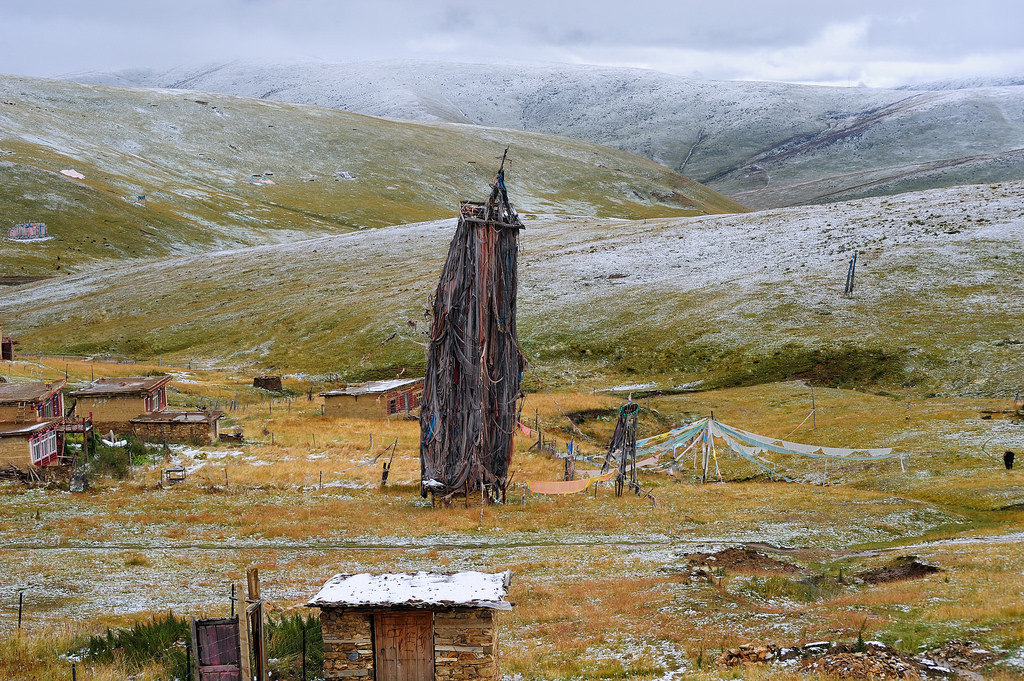
Pemako is a glittering spot in Arunachal Pradesh tourism map but indepth research, prompted by H&FW Minister Alo Libang and DyCM’s OSD Anupang Tangu unfolded much more than known about this mystic land as recorde by researchers of foreign universities.
Bhutan-based global tour operator Pema L Wangmo has shown her keenness to explore about this mystic land in future. Buddhist monks are globetrotters and if she projects in right perspective, Pemako would turn more Buddisht tourists after 400-year-oldTawang Buddhist monastery and Motongsa, also known as Kongmu located in inaccessible jungle along the Jairampur-Pagsau Pass route, perched at an elevation of 300 metres above sea level in ‘Patkai Bum’ ranges of eastern extension of Himalayas, near Myanmar border of Pangsau Pass, overlooking the infamous ‘Lake of no Return’ where many fighter planes had disappeared during World War II.
Nampong’s scenic beauty is simply beyond words; undulating mountains, thick jungles, beautiful rivers and a soul-captivating scenery peppered with serene treasures of rare Himalayan wildlife, rightly lend this place an unparalleled enigmatic charm that bounds to leave all its visitors hypnotized for their entire lives. But, Buddhist monks walk to its hillock. A huge stone slab with stone engraving and serenity justifies the divinity and importance of the pilgrimage. Buddhist monks from far and wide reach the place of pilgrimage by trekking on foot for two to three days. They worship and mediate there for days together and take shelter in the ‘staging hut’ built by Speaker Setong Sena before returning.
Tawang, the snow-clad hilly religious abode of Lord Buddha, has been described as last Sangri-La on the earth. The nature sings as the wild insects chirp intermittently; lovelorn call of the wild reverberates as mating season begins and perennial water-falls flow in rhythmic noise to justify Toru Dutt:
Oh, lovely are the woods at dawn,
And lovely in the sultry noon,
But loveliest, when the sun withdrawn
The twilight and the crescent moon!
Road to Beyul of Pemako: This is a blog about finding inner peace and happiness, my journey in finding Shambhala, the Buddhist Pure Land. The idea is ironic to me still, one has to give up in order to get, leave in order to reach, but I am learning, and I have set off to the road to Shambhala.
Yarlung Tsangpo-Brahmaputra: The Tsangpo-Brahmaputra is a major international river shared between Tibet/China, India and Bangladesh. On the Tibetan Plateau, the river flows west to east, across Southern Tibet, from its sources near the sacred Mt. Kailash all the way to the Great Bend, where the river turns north to take a sharp U-turn to flow south into India and then to Bangladesh. This river is hydrologically connected to the larger Ganges-Brahmaputra-Meghna basin.
The Yarlung Tsangpo River is intimately linked to the history of Tibetan civilization, indigenous religious beliefs and practices, and ultimately to the Tibetan identity. As the River Nile is to Egypt, Yarlung Tsangpo can be considered the cradle of Tibetan civilization. The Yarlung Valley is the home of the earliest Tibetan kings known as the Yarlung Dynasty. From its sources near the sacred Mt. Kailash, the Yarlung Tsangpo valley is dotted with pilgrimage sites and power-places such as meditation caves of past masters and beyul (hidden valleys) for spiritual practices. The river is also shown in paintings of the famous imagery of Tibet as a supine demoness.
The Tsangpo Gorge: The sacred Land of Pema Koe: To the Tibetans, the Great Bend region is known as Pema Koe, the most sacred beyul blessed by Guru Rinpoche, Padmasambhava, the Indian Buddhist yogin credited with firmly establishing Buddhism in Tibet. Generations of visionary Tibetan Buddhist masters have revealed “hidden treasures” and made journeys through the different layers of spiritual doors of beyul Pema Koe. Tibetans also consider the region as the home of the Goddess Dorje Phakmo (Vajra Yogini). It has attracted significant international attention as the “Last Secret Place on Earth”. Through the 19th century, cartographers were not certain whether Yarlung Tsangpo emerged from the other side of the Gorge as the Brahmaputra, the Irrawaddy, or some other river. Just downstream of Lungpe, the Yarlung Tsangpo enters one of the world’s deepest and largest gorges, starting from a 4,900-meter cleft between two of the highest mountains in Eastern Himalaya: 7756 meters high Namchak Barwa and 7294 meters tall Gyala Pelri. As the river drops nearly 2500 meters in altitude through the length of the bend, the gorge is considered ideal for hydropower generation. Speculation about the construction of the world’s most powerful dam and a major water diversion project at this site (discussed below) has been a major cause of concern in downstream countries.
It is also known as one of the most bio-diverse regions in the world in terms of plant species. Although it is hard to imagine how botanists studied and added up the numbers of different plant species in this hard-to-travel corner, this official site boasts the existence of 3,700 plant species and emphasizes “the primordial nature of the plants” in the region. The ecological integrity of the Great Bend area is critical for the conservation of the Himalayas as one the world’s richest but at greatest-risk areas for biodiversity hotspot.
Similar to the Tibet map depicted as a demoness lying on her back, this local trekking group describes the sacred geography of the Pema Koe region as mapped onto the body of the goddess Dorje Phakmo herself: “Her head is the Kangri Kangpo [White Snow Mountain], her two breasts [are] Namche Barwa and Gyala Peri [mountains] respectively. The lower part of her body lies in Yangsang or the innermost Pemako which is the upper Siang region of Arunachal Pradesh. In the confluence of Siang (Tsangpo) and Yangsang is the sacred tri[a]ngle Kila Yangzom the vulva of Goddess Dorje Phagmo.” These beliefs and pilgrimage practices have religious and cultural significance for millions of Buddhists around the world.


 20