
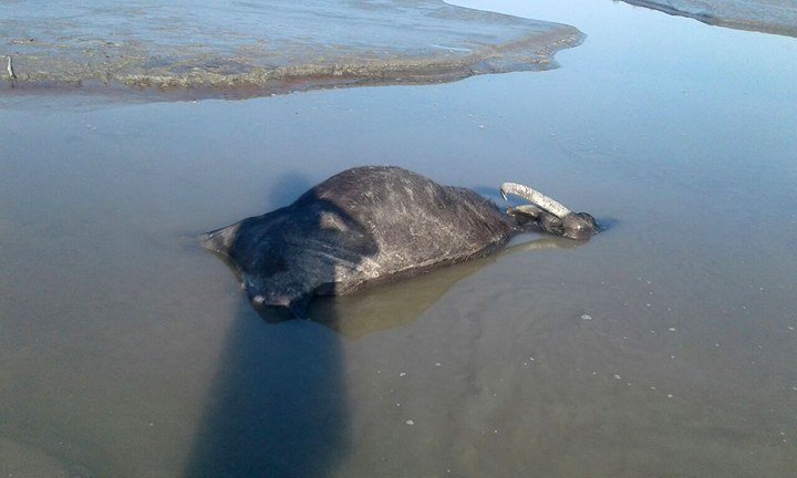
PASIGHAT | Dec 03 | Siang River, lifeline of Arunachal Pradesh for so long, has suddenly turned muddy at various places. The river water, which is always clean and clear during winters, is now full of thick black mud and dead fish this winter besides hundreds of buffaloes died and numerous migratory birds flew away from D. Ering WL Sanctuary. This prompted Chief Minister Pema Khandu to inspect the river on Saturday to take stock of the ground realities.
Khandu for the first time expressed deep concern here. There is apprehension about the possibility of China’s plan to dig a 1000-km tunnel to divert Yarlung Tsangpo River in Tibet from Tibet to Taklimakan Desert in Xinjiang, which could have contaminated the water.
On being apprised by Lok Sabha MP Ninong Ering, Disaster Management Parliamentary Secretary-cum-local MLA Kaling Moyong & DC Tamiyo Tatak about the prevailing situation, including finding of naphelometric turbidity unit (NTU) 425, whose prolonged prevalence may affect aquatic lives for and others, Khandu conveyed his Govt’s seriousness and in touch with New Delhi to take up the issue with China. The CM is likely to meet Home Minister Rajnath Singh shortly on the issue. The river is carrying cement and mortar from that river diversion construction from China to India and polluting crystal clear water
Khandu was accompanied by Dy CM Chowna Mein, State BJP President, Tapir Gao and Commissioner PWD, Bilati Pertin etc.
Ering Wildlife Sanctuary, located in islands criss-croseed by Siang River tributaries, receive migratory birds abundantly. But its officials disclosed that numerous birds have flown away and hardly seen anymore. Moreover, hundreds of buffaloes were reported dead in Khutis along Assam side, near the Sanctuary.
Locals apprehended that it might put human lives in danger if precautionary measures are not taken by Arunachal and Assam Govt soon.
The Manas River, which runs through Bhutan, joins it at Jogigopha, in India, is the 10th largest riverine the world by discharge, and the 15th longest. With its origin in the Angsi glacier, located on northern side of the Himalayas in Burang County of Tibet as Yarlung Tsangpo River, it flows across southern Tibet to break through the Himalayas in great gorges (including the Yarlung Tsangpo Grand Canyon) and enters Gelling in Upper Siang district of Arunachal Pradesh as Siang, Dibang and Lohit rivers join before it flows as Brahmaputra southwest through Assam Valley and south through Bangladesh as Jamuna (not Yamuna) In the vast Ganges Delta it merges with Padma, getting the name the popular name of river Ganges in Bangladesh and finally Meghna before emptying into the Bay of Bengal.
About 3,848 km long, Brahmaputra with average depth of 124 ft and maximum 380 ft, is an important river for irrigation and transportation. But it is prone to catastrophic flooding in the spring when Himalayas snow melts. The average discharge of the river is about 700,000 cu ft/s, and floods can reach over 3,500,000 cu ft/s). It is also one of the few rivers in the world that exhibit a tidal bore but navigable for most of its length. (With CMO inputs)


 20